Old Map Studies: Myths and Legends of the Ancient Mississippi River Valley as Told Through Maps!
Examples of proposed early exploration to the Americas include Figures 1 (Zheng He Map) and 4 (Piri Re’is Map). Chinese, European, Scandinavian and Arab alike have claimed an early presence in the Western Hemisphere. Many today are still unauthenticated, and are not considered among mainstream scholars to hold veritable truths. Others are authenticated and yet consensus cannot be reached as to their origin.
Figure 1. The Chinese
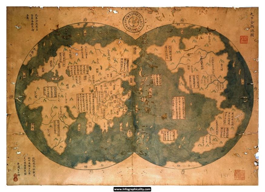
The Zheng He Map (c. 1421)
Much effort has gone into discrediting this map as it does not coincide with Mongolian tradition, but instead with European dual hemisphere maps. It is also questionable since, China did not include itself as the center of the map. For these reasons it is proposed as an elaborate hoax of an unreliable source. Compare with Figure 2.
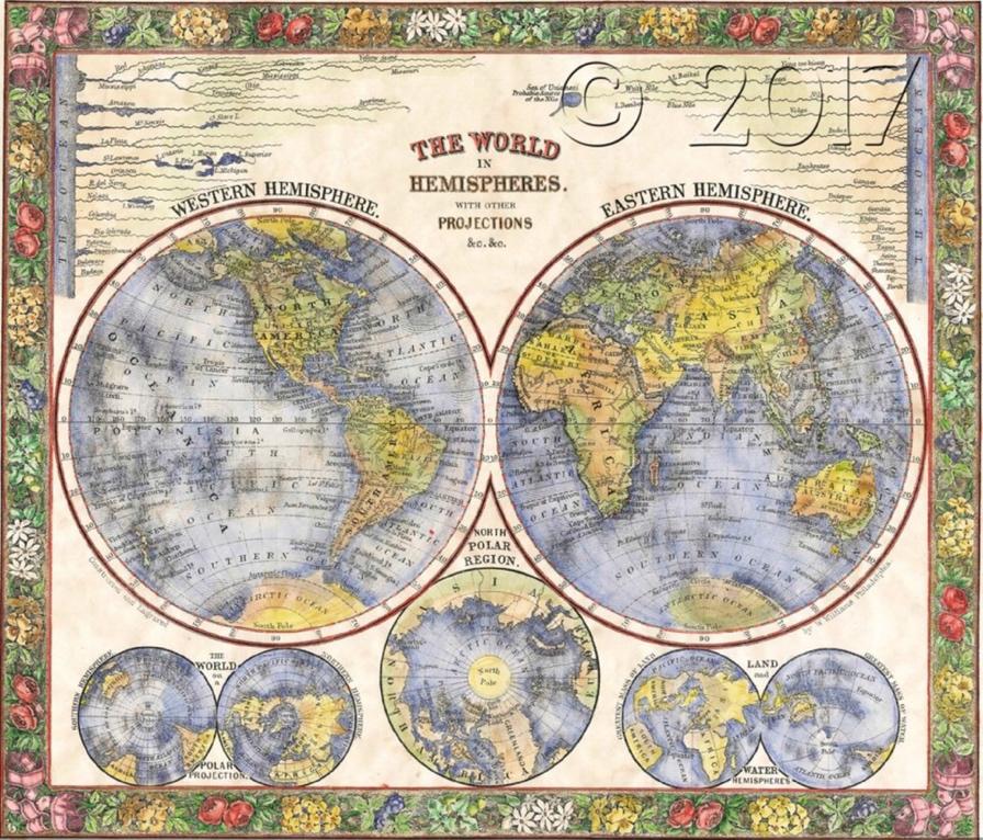
Figure 2. European
S. Augustus Mitchell Jr.’s World Map (c. 1864) Buy here!
Here is an example of a dual hemisphere map, of the European cartography tradition, of which the Zheng He map is said to imitate. It is pre-Mercatorial, meaning a meridian line is not used to alter the spherical nature of the map.
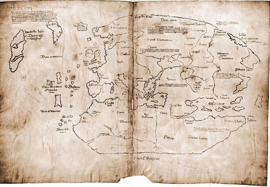
Figure 3. The Norse Vikings of Scandinavia
The Vinland Map (c. 1440)
Leif Erikson documented travels to Greenland (Newfoundland) prior to Columbus. Some consider it to be the only documented proof of pre-Columbian exploration to the American continents.
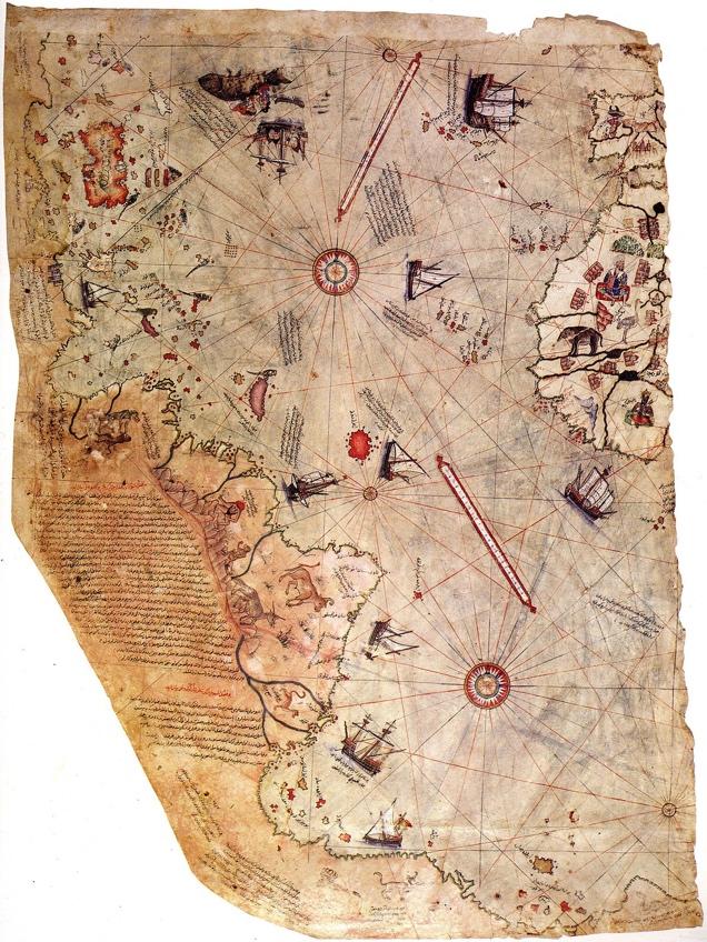
Figure 4. Arabs and The Ottoman Empire
Piri Re’is (Admiral) Map (c. 1513)
Here, the Turkish admiral, refers to Christopher Columbus “the infidel,” and attests to the Arabs having reached the Americas prior to the Spanish Queen. Albeit, he credits some of his references to a map still unaccounted for and drafted by Columbus. It is agreed by scholars to be authentically drawn and accurate as to date. However, the sources Piri Re’is drew from are in question.
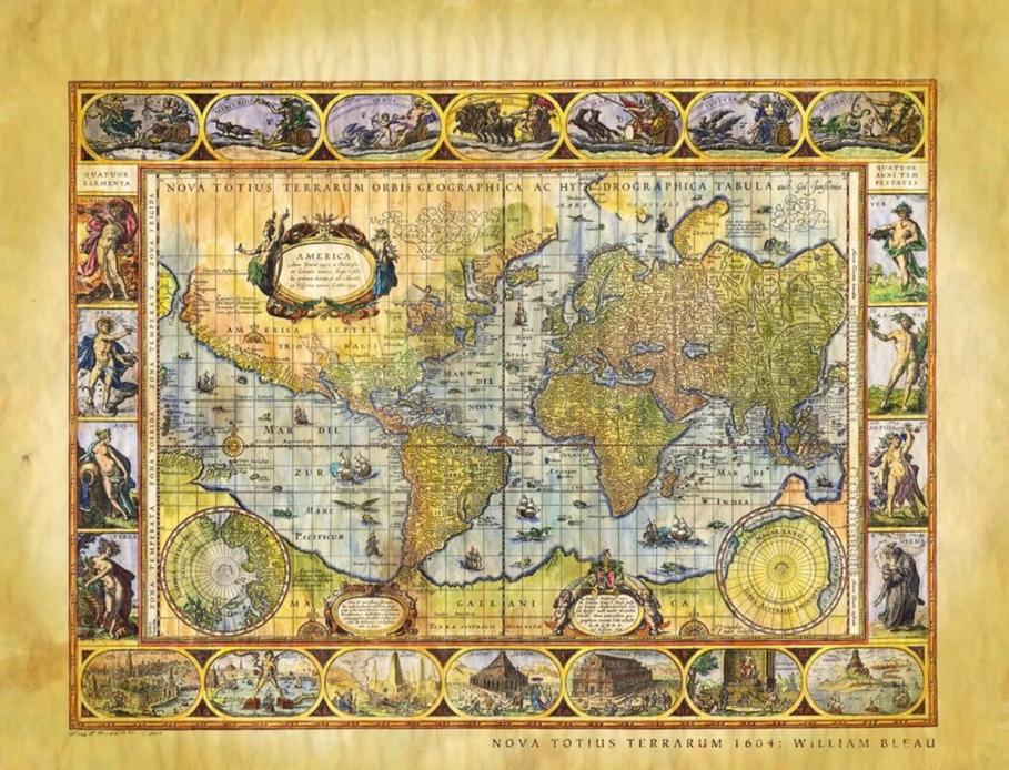
Figure 5. Willem Blaeu's Nova Totius Terrarum Orbis Geographica ac Hydrographica Tabula (circa 1694). Buy Here!
An example of the mercatorial projection in use.
Works Cited
-
Hapgood, Charles H., Maps of the Ancient Sea Kings: Evidence of Advanced Civilization in the Ice Age, (Souvenir, 2001), 3, footnote
-
Afetinan, A, Life and Works of Piri Reis: the Oldest Map of America, (Turkish Historical Society, 2008), 7, par. 1
-
Mann, Charles C, 1491: New Revelations of the Americas before Columbus, (Knopf, 2012), 15, par. 2
-
Golay, Michael, and John Stewart Bowman. North American Exploration, 18, par. 1
-
Fell, Barry, America B.C.: Ancient Settlers in the New World, (Hoffman Printing, 2012), 175, par. 3
-
Fell, Barry, America B.C.: Ancient Settlers in the New World, 257, par. 1
-
Fell, Barry, America B.C.: Ancient Settlers in the New World, 7, par. 1, 17, par. 2
-
Henretta, James A., et al, America: a Concise History, (Bedford/St. Martin's, 2010), 12, par. 3
-
Henretta, James A., et al, America: a Concise History, 13, par. 2
-
Menzies, Gavin, and Ian Hudson, Who Discovered America?: the Untold History of the Peopling of the Americas, (William Morrow, an Imprint of HarperCollins Publishers, 2014), 65, par. 1
-
Menzies, Gavin, and Ian Hudson, Who Discovered America?: the Untold History of the Peopling of the Americas, 65, par. 3
-
Menzies, Gavin, and Ian Hudson, Who Discovered America?: the Untold History of the Peopling of the Americas, 66, par. 4
-
Menzies, Gavin, and Ian Hudson, Who Discovered America?: the Untold History of the Peopling of the Americas, 119, par. 1
-
Afetinan, A, Life and Works of Piri Reis: the Oldest Map of America, 30, par. 3
-
Hapgood, Charles H., Preface to Maps of the Ancient Sea Kings: Evidence of Advanced Civilization in the Ice Age
-
Skelton, Raleigh Ashlin., et al, The Vinland Map and the Tartar Relation, (Yale Univ. Press, 1995), 233, par. 1
-
Skelton, Raleigh Ashlin., et al, The Vinland Map and the Tartar Relation, 233, par. 1
-
Skelton, Raleigh Ashlin., et al, The Vinland Map and the Tartar Relation, 233, par. 2
-
Skelton, Raleigh Ashlin., et al, The Vinland Map and the Tartar Relation, 233, par.1