News
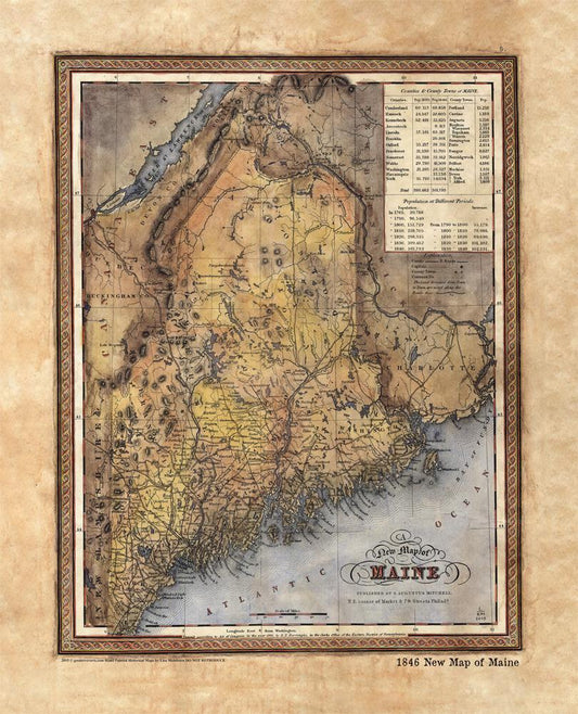
Discovery Map Series: 1846 New Map Of Maine
This map is significant in that it appeared in 28 different versions between the years 1833 and 1860. Originally, Henry Tanner, a prominent map publisher from Philadelphia, created the map...
Discovery Map Series: 1846 New Map Of Maine
This map is significant in that it appeared in 28 different versions between the years 1833 and 1860. Originally, Henry Tanner, a prominent map publisher from Philadelphia, created the map...
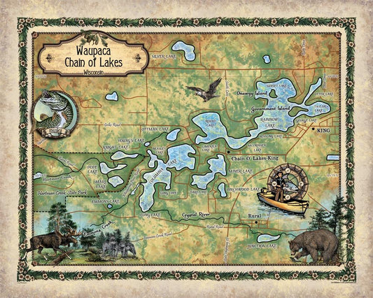
Tuesday Travel Feature: Chain O' Lakes, Waupaca...
There’s more to a lake than it simply being a body of water. Many lakes have helped to shape the vibrant history and culture of certain regions. Lakes provides environmental...
Tuesday Travel Feature: Chain O' Lakes, Waupaca...
There’s more to a lake than it simply being a body of water. Many lakes have helped to shape the vibrant history and culture of certain regions. Lakes provides environmental...
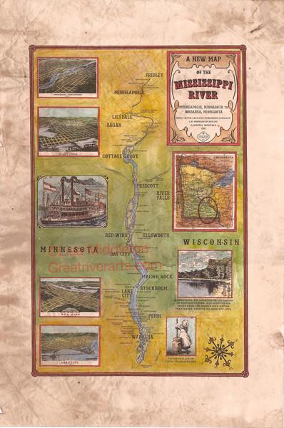
Tuesday Travel Feature: Upper Mississippi River...
Upper Missippi River Map Fridley-Wabasha Famous Folk on the River This map depicts the upper portion of the Mississippi River from Fridely to Wabasha. This is a portion of the...
Tuesday Travel Feature: Upper Mississippi River...
Upper Missippi River Map Fridley-Wabasha Famous Folk on the River This map depicts the upper portion of the Mississippi River from Fridely to Wabasha. This is a portion of the...
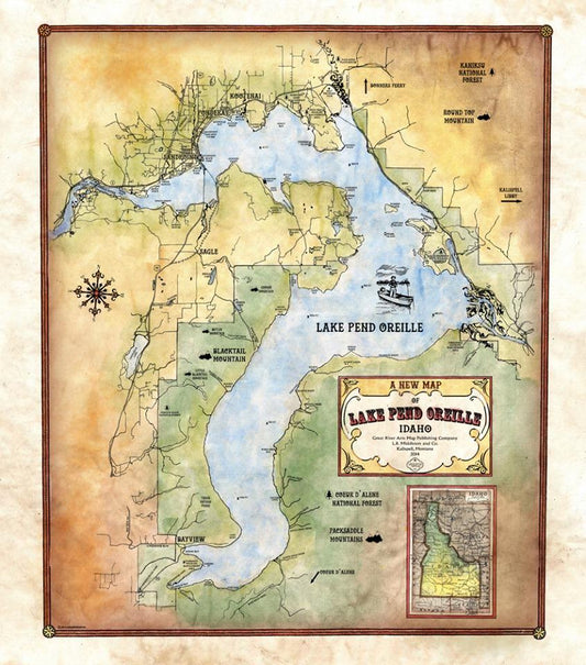
Travel Map Feature: Lake Pend Oreille, Idaho
Lake Pend Oreille is the largest lake in the northern Idaho panhandle and the largest lake in Idaho with a length of 43 miles and a surface area of 148...
Travel Map Feature: Lake Pend Oreille, Idaho
Lake Pend Oreille is the largest lake in the northern Idaho panhandle and the largest lake in Idaho with a length of 43 miles and a surface area of 148...