News
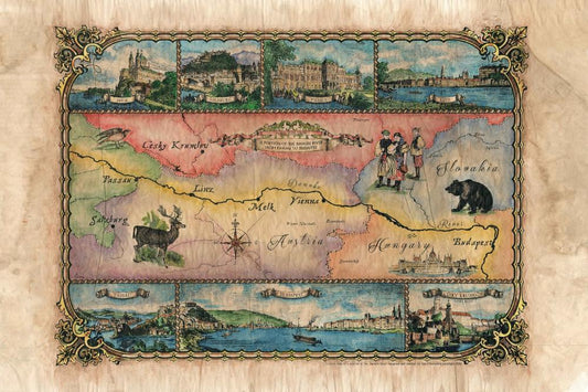
Travel Map Feature: Danube River, Passau to Bud...
A lot can be said about the Danube. In fact, a lot has been said. Songs and poems have been written about life on and around its banks. It has...
Travel Map Feature: Danube River, Passau to Bud...
A lot can be said about the Danube. In fact, a lot has been said. Songs and poems have been written about life on and around its banks. It has...
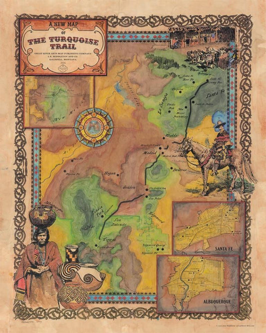
Discovery Map Series: Custom map of the Turquoi...
The Turquoise Trail, New Mexico Situated in central New Mexico, beginning in Tijeras and the Cibola National Forest and ending in the San Marcos/Lone Butte Area, the Turquoise Trail is...
Discovery Map Series: Custom map of the Turquoi...
The Turquoise Trail, New Mexico Situated in central New Mexico, beginning in Tijeras and the Cibola National Forest and ending in the San Marcos/Lone Butte Area, the Turquoise Trail is...
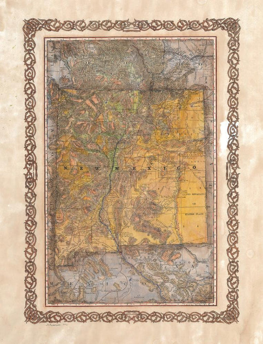
Discovery Map Series: New Mexico Wagon Roads 1879
This map was originally taken from a Rand McNally Atlas c. 1879. It illustrates 19th Century New Mexican wagon roads, counties, military outposts, Native American reserves, volcanic fields, stage routes,...
Discovery Map Series: New Mexico Wagon Roads 1879
This map was originally taken from a Rand McNally Atlas c. 1879. It illustrates 19th Century New Mexican wagon roads, counties, military outposts, Native American reserves, volcanic fields, stage routes,...
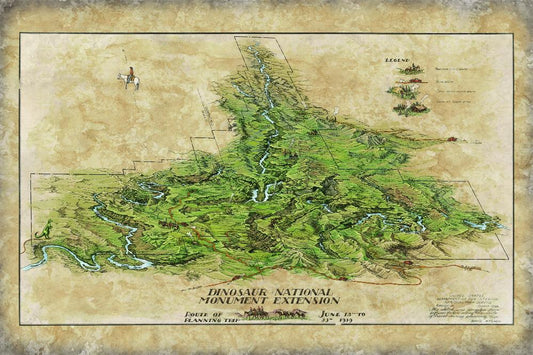
Discovery Map Series: Dinosaur National Monument
In a land where dinosaurs roamed centuries ago, remains the fantastic relics of their existence, along with a rich cultural history, preserved in the petroglyphs and pictographs left behind by...
Discovery Map Series: Dinosaur National Monument
In a land where dinosaurs roamed centuries ago, remains the fantastic relics of their existence, along with a rich cultural history, preserved in the petroglyphs and pictographs left behind by...

Ireland Map
The mapping of Ireland during the 16th and 17th centuries reflected a period of political and religious shifts that shaped the territory. However, it also showed the cartographic advancements of...
Ireland Map
The mapping of Ireland during the 16th and 17th centuries reflected a period of political and religious shifts that shaped the territory. However, it also showed the cartographic advancements of...
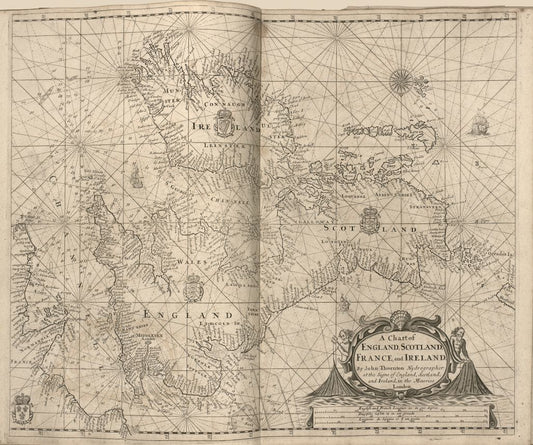
A Chart of England, Scotland, France, and Ireland
A Chart of England, Scotland, France, and Ireland is the shortened name of a portolan chart that goes by a couple of other names, including “Sea-atlas, Containing an Hydrographical Description...
A Chart of England, Scotland, France, and Ireland
A Chart of England, Scotland, France, and Ireland is the shortened name of a portolan chart that goes by a couple of other names, including “Sea-atlas, Containing an Hydrographical Description...