News
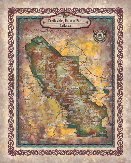
Discovery Map Series: The sites of Death Valley...
Straddling the California-Nevada border, Death Valley National Park occupies a desert valley area between the arid Great Basin and Mojave deserts. It is the hottest and driest place in America,...
Discovery Map Series: The sites of Death Valley...
Straddling the California-Nevada border, Death Valley National Park occupies a desert valley area between the arid Great Basin and Mojave deserts. It is the hottest and driest place in America,...
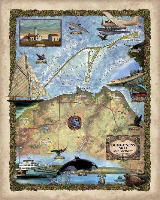
Discovery Map Series: Dungeness Spit, Washington
Stretching for roughly 6 miles east of Port Angeles and jutting into the Strait of Juan de Fuca, Dungeness Spit is the longest natural sand spit in the United States....
Discovery Map Series: Dungeness Spit, Washington
Stretching for roughly 6 miles east of Port Angeles and jutting into the Strait of Juan de Fuca, Dungeness Spit is the longest natural sand spit in the United States....
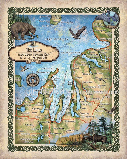
Discovery Map Series: Petoski Lakes, Beaver Isl...
Michigan is known as the Great Lakes State, and the name Michigan comes from the Native American word “Mishigamaa” which means “large lake.” Its beautiful, natural surroundings include 3,177 miles...
Discovery Map Series: Petoski Lakes, Beaver Isl...
Michigan is known as the Great Lakes State, and the name Michigan comes from the Native American word “Mishigamaa” which means “large lake.” Its beautiful, natural surroundings include 3,177 miles...
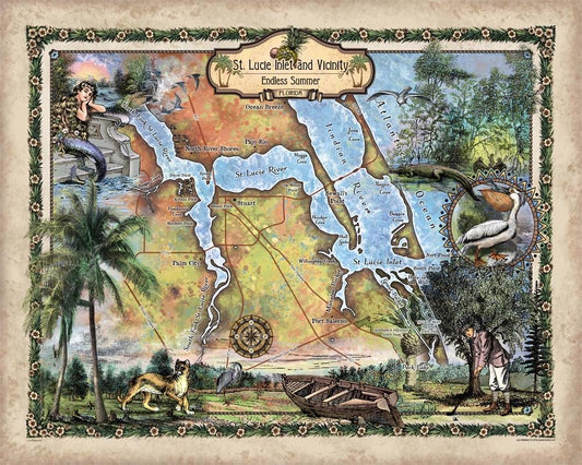
Travel Tuesday Map Series: St. Lucie Inlet, Flo...
Immediately south of Jupiter Inlet Light in Palm Beach County, Florida is Jupiter Inlet, an opening in the beach, that leads to Jupiter Sound on the north, Loxahatchee River on...
Travel Tuesday Map Series: St. Lucie Inlet, Flo...
Immediately south of Jupiter Inlet Light in Palm Beach County, Florida is Jupiter Inlet, an opening in the beach, that leads to Jupiter Sound on the north, Loxahatchee River on...