News
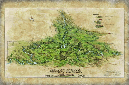
Discovery Map Series: Dinosaur National Monument
In a land where dinosaurs roamed centuries ago, remains the fantastic relics of their existence, along with a rich cultural history, preserved in the petroglyphs and pictographs left behind by...
Discovery Map Series: Dinosaur National Monument
In a land where dinosaurs roamed centuries ago, remains the fantastic relics of their existence, along with a rich cultural history, preserved in the petroglyphs and pictographs left behind by...

Ireland Map
The mapping of Ireland during the 16th and 17th centuries reflected a period of political and religious shifts that shaped the territory. However, it also showed the cartographic advancements of...
Ireland Map
The mapping of Ireland during the 16th and 17th centuries reflected a period of political and religious shifts that shaped the territory. However, it also showed the cartographic advancements of...
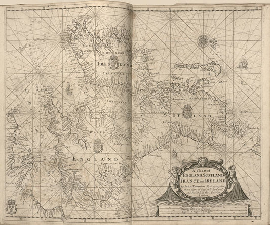
A Chart of England, Scotland, France, and Ireland
A Chart of England, Scotland, France, and Ireland is the shortened name of a portolan chart that goes by a couple of other names, including “Sea-atlas, Containing an Hydrographical Description...
A Chart of England, Scotland, France, and Ireland
A Chart of England, Scotland, France, and Ireland is the shortened name of a portolan chart that goes by a couple of other names, including “Sea-atlas, Containing an Hydrographical Description...
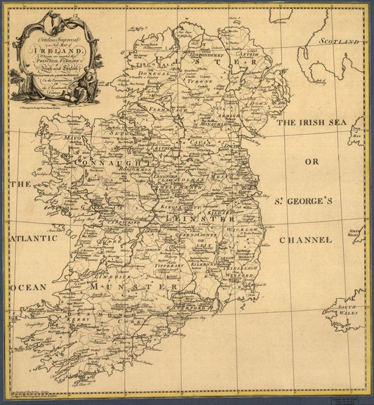
Ortelius Improved Or New Map Of Ireland
Ortelius Improved, or a New Map of Ireland: Wherin are Inserted the Principal Families of Irish and English Extraction, Who Possess'd that Kingdon on the Commencement of the Seventeenth Century...
Ortelius Improved Or New Map Of Ireland
Ortelius Improved, or a New Map of Ireland: Wherin are Inserted the Principal Families of Irish and English Extraction, Who Possess'd that Kingdon on the Commencement of the Seventeenth Century...
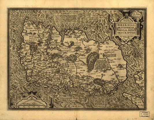
Hiberniae Britannicae
This Abraham Ortelius map, Hiberniae, Britannicae Insvlae Nova Descripto, is an early map of Ireland published in 1598. It was first published in 1573 and is compiled from Gerardus Mercator's 1564...
Hiberniae Britannicae
This Abraham Ortelius map, Hiberniae, Britannicae Insvlae Nova Descripto, is an early map of Ireland published in 1598. It was first published in 1573 and is compiled from Gerardus Mercator's 1564...
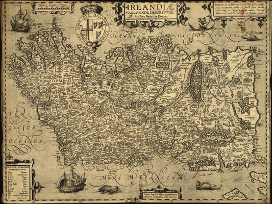
Baptista Boazio's Irlandiæ c. 1606
Some call it Irlandiæ accvrata descriptio and others say Irlandiæ accurata descriptio, but the map Baptista Boazio's Irlandiæ c. 1606 = Irlandiæ accvrata descriptio is a magnificent work of art, science, and geographical knowledge...
Baptista Boazio's Irlandiæ c. 1606
Some call it Irlandiæ accvrata descriptio and others say Irlandiæ accurata descriptio, but the map Baptista Boazio's Irlandiæ c. 1606 = Irlandiæ accvrata descriptio is a magnificent work of art, science, and geographical knowledge...