News
Travel Map Feature: Port Clinton, Marblehead Is...
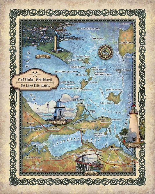
The Ohio regions of Port Clinton, Marblehead and Lake Erie Islands are rich in history and scenic beauty, and attracts many each year, who are looking for fun, adventure or...
Travel Map Feature: Port Clinton, Marblehead Is...
The Ohio regions of Port Clinton, Marblehead and Lake Erie Islands are rich in history and scenic beauty, and attracts many each year, who are looking for fun, adventure or...
Discovery Map Series: Antarctic Exploration - R...
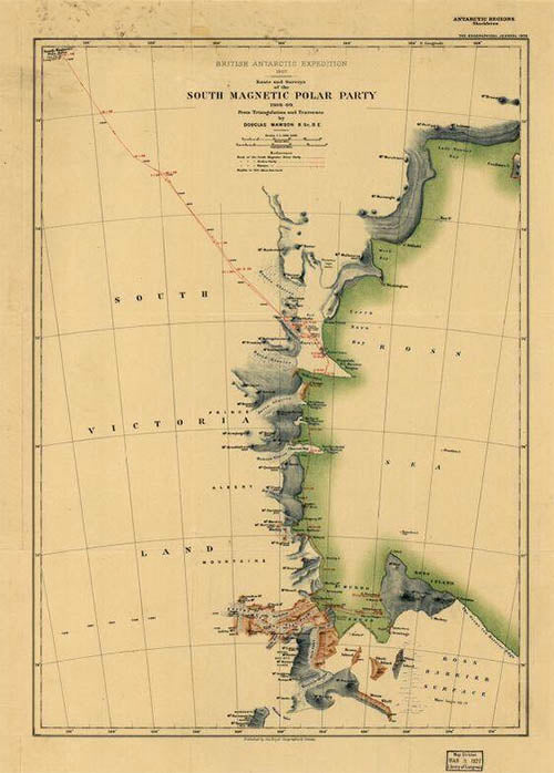
The Route and Surveys of the South Magnetic Polar Party, 1908-09 was published in England by the Royal Geographic Society in 1909. The primary contributors of this map are Douglas Mawson,...
Discovery Map Series: Antarctic Exploration - R...
The Route and Surveys of the South Magnetic Polar Party, 1908-09 was published in England by the Royal Geographic Society in 1909. The primary contributors of this map are Douglas Mawson,...
Discovery Map Series: Authorized map of the Sec...
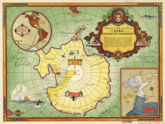
Issued by the General Food Corporation in 1934, the work “Authorized Map of the Second Byrd Antarctic Expedition” is a fascinating, colored pictorial map that focuses on the exploration and...
Discovery Map Series: Authorized map of the Sec...
Issued by the General Food Corporation in 1934, the work “Authorized Map of the Second Byrd Antarctic Expedition” is a fascinating, colored pictorial map that focuses on the exploration and...
Travel Map Feature: 012 Alaska 1906
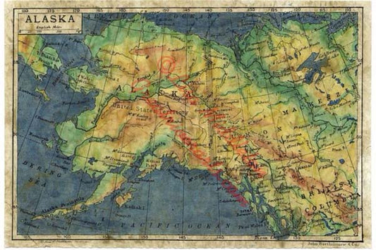
This is a colored version of the 1906 map of Alaska by John Bartholomew, the english Cartographer. It was originally surveyed by Bartholomew in 1895 but did not reach publication...
Travel Map Feature: 012 Alaska 1906
This is a colored version of the 1906 map of Alaska by John Bartholomew, the english Cartographer. It was originally surveyed by Bartholomew in 1895 but did not reach publication...
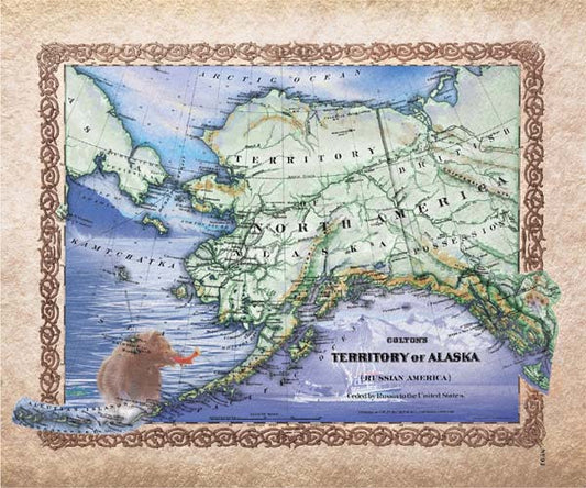
Travel Map Feature: 232 Territory of Alaska
In 1912, an Organic Act renamed the District of Alaska, the Territory of Alaska, which allowed Alaska to be represented in the federal government via a congressional delegate. The territory...
Travel Map Feature: 232 Territory of Alaska
In 1912, an Organic Act renamed the District of Alaska, the Territory of Alaska, which allowed Alaska to be represented in the federal government via a congressional delegate. The territory...
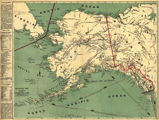
Discovery Map Series: Millroy's map of Alaska a...
The Rand, McNally & Co.'s Alaska map is the work of Rand, McNally and Company, published in Chicago in 1878. It is from the Rand McNally & Co's Business Atlas...
Discovery Map Series: Millroy's map of Alaska a...
The Rand, McNally & Co.'s Alaska map is the work of Rand, McNally and Company, published in Chicago in 1878. It is from the Rand McNally & Co's Business Atlas...