News
Discovery Map Series: The Route of the Alaska E...
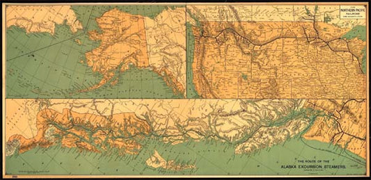
Charles S. Fee’s 1891 map, titled “The Route of the Alaska Excursion Steamers” shows the routes of the Alaskan Steams from cities in the U.S and Canada to different locations...
Discovery Map Series: The Route of the Alaska E...
Charles S. Fee’s 1891 map, titled “The Route of the Alaska Excursion Steamers” shows the routes of the Alaskan Steams from cities in the U.S and Canada to different locations...
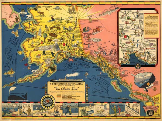
Discovery Map Series: The Alaska Line
The Rand, McNally & Co.'s Alaska map is the work of Rand, McNally and Company, published in Chicago in 1878. It is from the Rand McNally & Co's Business Atlas...
Discovery Map Series: The Alaska Line
The Rand, McNally & Co.'s Alaska map is the work of Rand, McNally and Company, published in Chicago in 1878. It is from the Rand McNally & Co's Business Atlas...
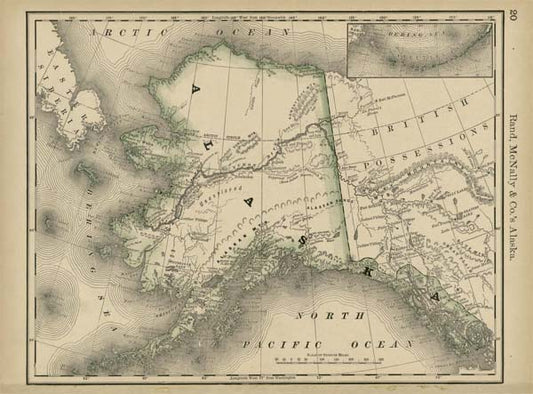
Discovery Map Series: Old Alaska Collection
In March of 1867, the United States purchase Alaska from Russia, expanding U.S. territory in the north. Only a small number of non-natives settled in Alaska in the decade after...
Discovery Map Series: Old Alaska Collection
In March of 1867, the United States purchase Alaska from Russia, expanding U.S. territory in the north. Only a small number of non-natives settled in Alaska in the decade after...
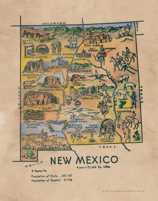
Discovery Map Series: Kid's Map of New Mexico
This pictorial and whimsical map illustration of New Mexico is believed to have its origin in a coloring book published in the 1950s. While the maker is unknown, the charm...
Discovery Map Series: Kid's Map of New Mexico
This pictorial and whimsical map illustration of New Mexico is believed to have its origin in a coloring book published in the 1950s. While the maker is unknown, the charm...
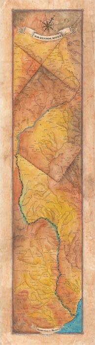
Travel Map Feature: 226 Rio Grande River Map
The fourth longest river in the U.S., the Rio Grande, originates in the Rocky Mountains at the southwestern part of Colorado, twisting like a snake across the Southwest, passing through...
Travel Map Feature: 226 Rio Grande River Map
The fourth longest river in the U.S., the Rio Grande, originates in the Rocky Mountains at the southwestern part of Colorado, twisting like a snake across the Southwest, passing through...
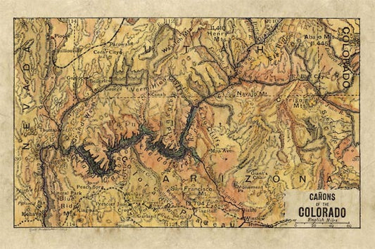
Discovery Map Series: 025 Canyons of the Colora...
Extremely beautiful colorization of Bartholomew's Canyons of the Colorado 1906 map. Features Grand Canyon. One of Lisa's favorites. Other sizes are available, as well as originals. Lisa's maps are known...
Discovery Map Series: 025 Canyons of the Colora...
Extremely beautiful colorization of Bartholomew's Canyons of the Colorado 1906 map. Features Grand Canyon. One of Lisa's favorites. Other sizes are available, as well as originals. Lisa's maps are known...