News
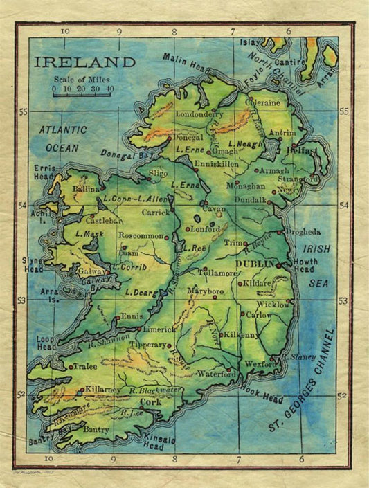
Travel Map Feature: 057 Ireland 1906
Ireland has long been known for being the Emerald Isle... and drinking. It seems that the two go hand in hand. As it turns out, things were not that much...
Travel Map Feature: 057 Ireland 1906
Ireland has long been known for being the Emerald Isle... and drinking. It seems that the two go hand in hand. As it turns out, things were not that much...
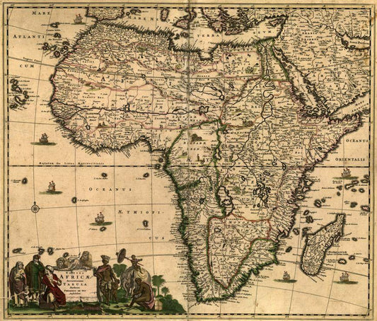
Discovery Map Series: Africae Accuratissima
An early map of Africa, Totius Africæ Accuratissima Tabula, is believed to have been published in Amsterdam in 1688 and is the work of Fredrik de Wit. Who was Fredrik...
Discovery Map Series: Africae Accuratissima
An early map of Africa, Totius Africæ Accuratissima Tabula, is believed to have been published in Amsterdam in 1688 and is the work of Fredrik de Wit. Who was Fredrik...
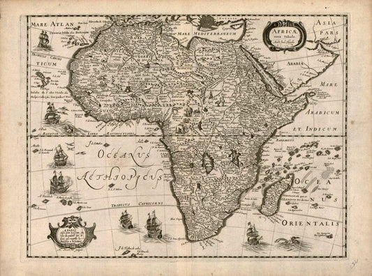
Discovery Map Series: Africae Nova
This mid-17th century map, Africae Nova Tabula, created by the Dutch cartographer Jodocus Hondius (1563-1612), is a beautiful decorative map of the continent of Africa, and was published in 1640...
Discovery Map Series: Africae Nova
This mid-17th century map, Africae Nova Tabula, created by the Dutch cartographer Jodocus Hondius (1563-1612), is a beautiful decorative map of the continent of Africa, and was published in 1640...
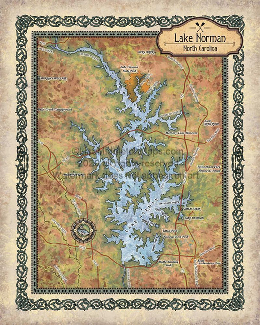
Travel Map Feature: Lake Norman, North Carolina
The Lake Norman region supports a diverse flora and fauna. Aquatic plants include alligatorweed, coon’s tail, waterweed, while common species of trees comprises bald cypress, water tupelo, red maple, sweetgum,...
Travel Map Feature: Lake Norman, North Carolina
The Lake Norman region supports a diverse flora and fauna. Aquatic plants include alligatorweed, coon’s tail, waterweed, while common species of trees comprises bald cypress, water tupelo, red maple, sweetgum,...
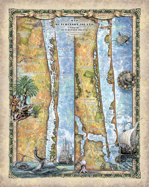
Travel Map Feature: North and South Hutchinson ...
Hutchinson Island is known for its beautiful, pristine, sandy beaches, nature preserves and parks. The long, thin island stretches for 23 miles and is over a mile wide at various...
Travel Map Feature: North and South Hutchinson ...
Hutchinson Island is known for its beautiful, pristine, sandy beaches, nature preserves and parks. The long, thin island stretches for 23 miles and is over a mile wide at various...
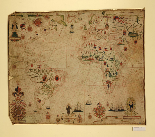
Discovery Map Series: Portolan Chart of Africa
In 1633, Pascal Roiz created the nautical chart titled by cataloger, A Portolan Chart of the Atlantic Ocean and Adjacent Continents. Pascoal Roiz was a Portuguese cartographer and portolan maker...
Discovery Map Series: Portolan Chart of Africa
In 1633, Pascal Roiz created the nautical chart titled by cataloger, A Portolan Chart of the Atlantic Ocean and Adjacent Continents. Pascoal Roiz was a Portuguese cartographer and portolan maker...