News
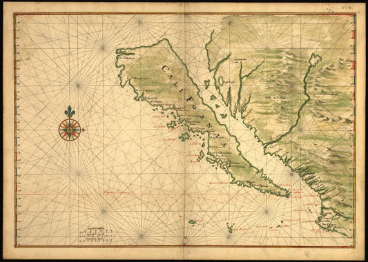
Discovery Map Series: Map of California Shown A...
A 1650 map, created by Joan Vinckeboon, titled “Map of California Shown as an Island," echoes the inaccurate belief of cartographers, whose early maps depicted California as an island, separate from mainland...
Discovery Map Series: Map of California Shown A...
A 1650 map, created by Joan Vinckeboon, titled “Map of California Shown as an Island," echoes the inaccurate belief of cartographers, whose early maps depicted California as an island, separate from mainland...
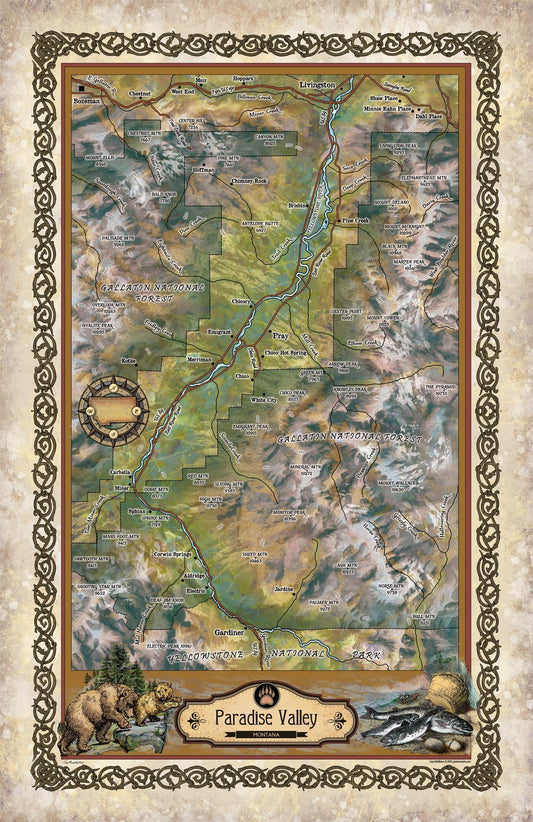
Travel Tuesday Map Feature: Paradise Valley, MT
In southwestern Montana, just north of Yellowstone National Park and nestled between the Absaroka Range to the east and the Gallatin Range to the west is Paradise Valley. This Montana...
Travel Tuesday Map Feature: Paradise Valley, MT
In southwestern Montana, just north of Yellowstone National Park and nestled between the Absaroka Range to the east and the Gallatin Range to the west is Paradise Valley. This Montana...
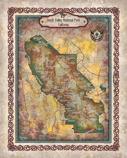
Travel Tuesday Map Feature: The Sites Of Death ...
Straddling the California-Nevada border, Death Valley National Park occupies a desert valley area between the arid Great Basin and Mojave deserts. It is the hottest and driest place in America,...
Travel Tuesday Map Feature: The Sites Of Death ...
Straddling the California-Nevada border, Death Valley National Park occupies a desert valley area between the arid Great Basin and Mojave deserts. It is the hottest and driest place in America,...
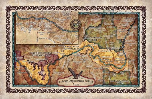
Travel Tuesday Map Feature: Grand Canyon Sites ...
The Grand Canyon became a National Park in 1919 and is undoubtedly one of the world’s natural wonders. Situated in Arizona, the park is 277 miles long, roughly 18 miles...
Travel Tuesday Map Feature: Grand Canyon Sites ...
The Grand Canyon became a National Park in 1919 and is undoubtedly one of the world’s natural wonders. Situated in Arizona, the park is 277 miles long, roughly 18 miles...

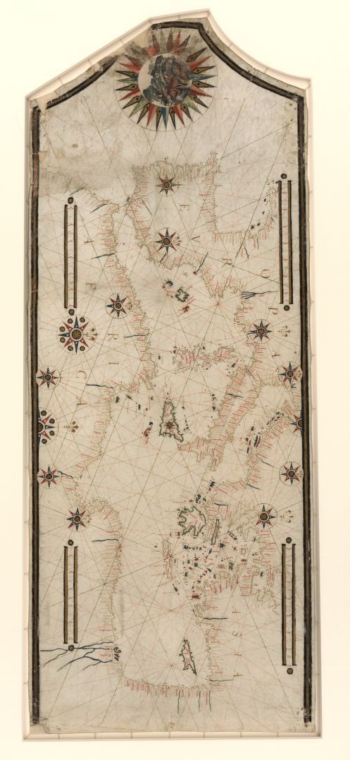
Discovery Map Series: Portolan Chart Of The Med...
It was in the year 1793 that Captain James Colnett of the Royal Navy set sail in the merchant ship Rattler to do a survey of the Galapagos Islands to...
Discovery Map Series: Portolan Chart Of The Med...
It was in the year 1793 that Captain James Colnett of the Royal Navy set sail in the merchant ship Rattler to do a survey of the Galapagos Islands to...
Discovery Map Series: Portolan Chart Of The Med...
It was in the year 1793 that Captain James Colnett of the Royal Navy set sail in the merchant ship Rattler to do a survey of the Galapagos Islands to...
Discovery Map Series: Portolan Chart Of The Med...
It was in the year 1793 that Captain James Colnett of the Royal Navy set sail in the merchant ship Rattler to do a survey of the Galapagos Islands to...