News
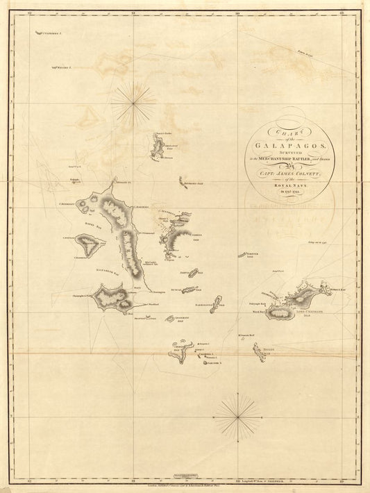
Discovery Map Series: Earliest Chart Of The Gal...
It was in the year 1793 that Captain James Colnett of the Royal Navy set sail in the merchant ship Rattler to do a survey of the Galapagos Islands to...
Discovery Map Series: Earliest Chart Of The Gal...
It was in the year 1793 that Captain James Colnett of the Royal Navy set sail in the merchant ship Rattler to do a survey of the Galapagos Islands to...
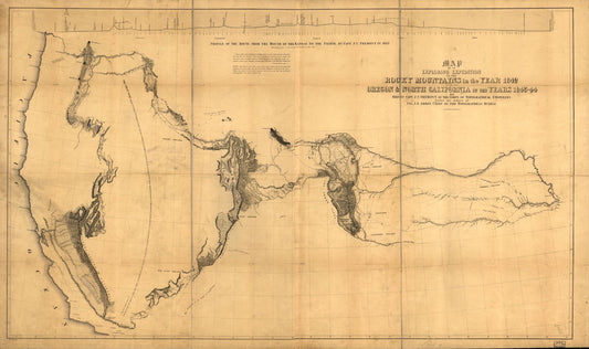
Discovery Map Series: Expedition Through The Ro...
Called the “Pathfinder,” John Charles Fremont was a skilled surveyor, mathematician and explorer who ventured on important expeditions deep into the American West. His work "Map of an Exploring Expedition to...
Discovery Map Series: Expedition Through The Ro...
Called the “Pathfinder,” John Charles Fremont was a skilled surveyor, mathematician and explorer who ventured on important expeditions deep into the American West. His work "Map of an Exploring Expedition to...
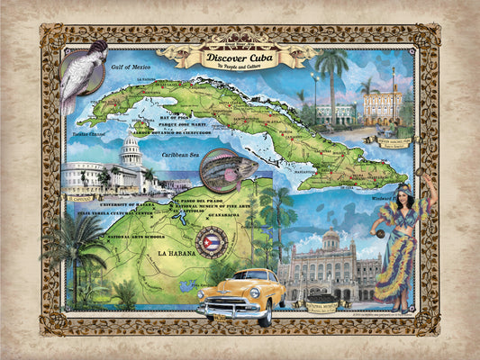
Our Travel Tuesday Feature Map: Discover Cuba
This Caribbean Island nation sits between the Caribbean Sea and the North Atlantic Ocean, and is 150km south of Key West, Florida. In its historic, artistic, cultural, and geographic...
Our Travel Tuesday Feature Map: Discover Cuba
This Caribbean Island nation sits between the Caribbean Sea and the North Atlantic Ocean, and is 150km south of Key West, Florida. In its historic, artistic, cultural, and geographic...
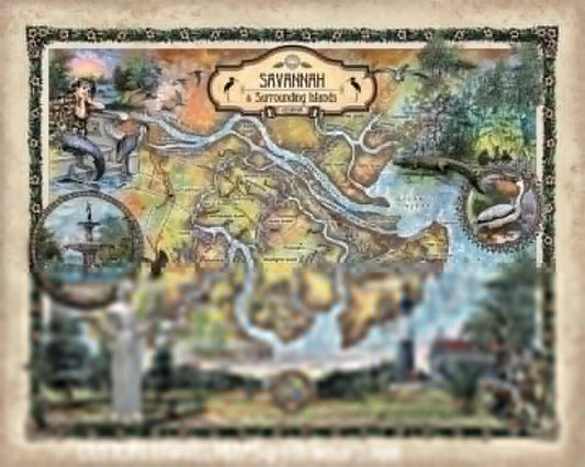
Travel Tuesday Map Feature: Savannah and Tybee ...
Use discount code SAV to get 50% off! Affectionately dubbed the “The Hostess City of the South,” Savannah was established in 1733 and is known to be the oldest city...
Travel Tuesday Map Feature: Savannah and Tybee ...
Use discount code SAV to get 50% off! Affectionately dubbed the “The Hostess City of the South,” Savannah was established in 1733 and is known to be the oldest city...
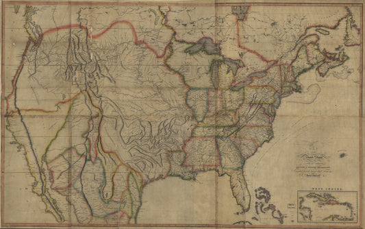
Discovery Map series: The First Transcontinenta...
Regarded as one of the most significant maps of the 19th century, John Melish’s “Map of the United States of America: With the Contiguous British and Spanish Possessions, 1816,” depicts...
Discovery Map series: The First Transcontinenta...
Regarded as one of the most significant maps of the 19th century, John Melish’s “Map of the United States of America: With the Contiguous British and Spanish Possessions, 1816,” depicts...